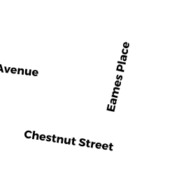
30 CHESTNUT ST
Owner Information
COHEN, PAUL E & ANNE M
30 CHESTNUT ST
AMHERST, MA 01002


Property Details
30 CHESTNUT ST is classified as a Single Family Residential (Farmhouse).
The primary structure on this property was built in 1930. There are 3,026ft2 of built area within this property. There is 1,592ft2 of residential/living space within this property. This property is listed as having 6 rooms.
30 CHESTNUT ST is valued at $359,800. The land is valued at $158,500 and the structures are valued at $193,700. There is an additional valuation of $7,600 on this property.
This property is in Zone RG10. Confirm with local Zoning Board authorities to ensure there are no overlays or other easements on this property.
The most recent deed for 30 CHESTNUT ST is recorded at the local registrar in Book 1957, Page 0141. 30 CHESTNUT ST was last sold on Friday, June 17, 1977 for $37,000.
Assessment data from fiscal year 2022.
Flood Data
According to the FEMA National Flood Hazard Layer, this property does not appear to be in a flood zone. It may also be in an area not yet reviewed. Nonetheless, confirm this information prior to taking any action.
To view the flood hazards around this property, create a FEMA "Firmette" Map of the area around 30 CHESTNUT ST.
Broadband Internet Providers
| Provider | Type | Bandwidth (mbps) | |
|---|---|---|---|
| GCI Communication Corp. | Satellite | 0 | 0 |
| Comcast | Cable | 1000 | 35 |
| Verizon New England Inc. | DSL | 15 | 1 |
| VSAT Systems, LLC. | Satellite | 2 | 1 |
| Viasat Inc | Satellite | 100 | 3 |
| T-Mobile | Fixed Wireless | 25 | 3 |
| HughesNet | Satellite | 25 | 3 |
Broadband service provider data from December 2020.
Adjacent Properties
- 36 CHESTNUT ST
Single Family Residential owned by BOUTILIER, EMILY G & ROBERT K - 112 COTTAGE ST
Single Family Residential owned by MEADOWS, CRAIG E & PAMELA ARNOLD - 22 EAMES AVE
Single Family Residential owned by CLAY, WHARTON C & TIFFANY R - 15 EAMES AVE
Single Family Residential owned by BAUMGARDT FREDERIK & DEE STELLA - 24 CHESTNUT ST
Single Family Residential owned by PROKOPOVYCH, BOGDAN & INA G